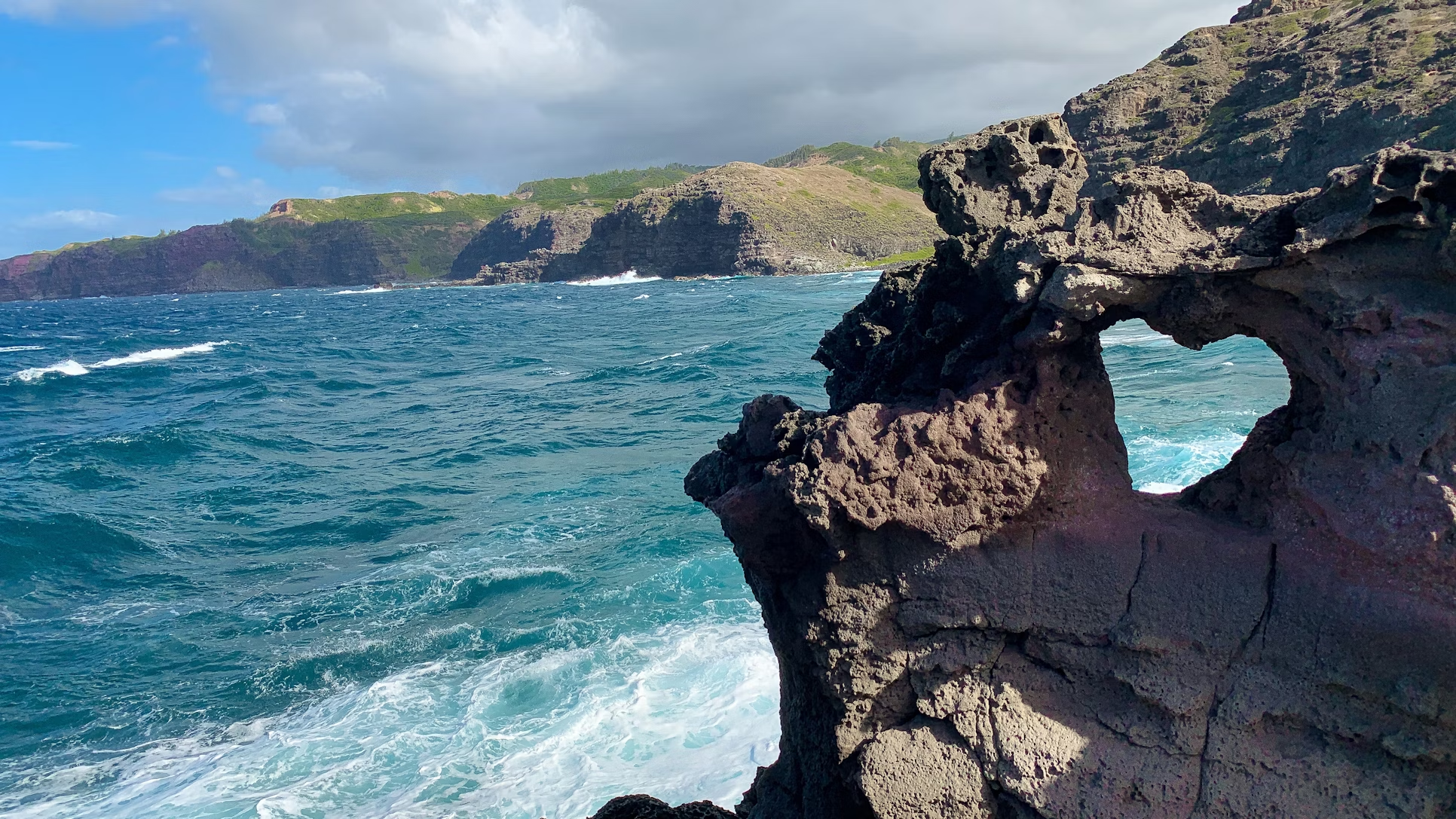
Best Hikes in Boulder: Trails, Trailheads, and Epic Views
Boulder, Colorado is a fantastic destination for hikers of all skill levels.
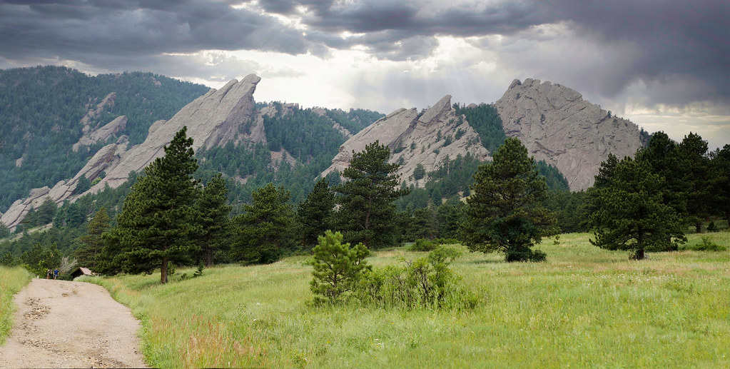
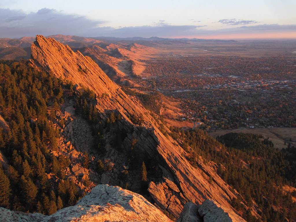
Nestled at the base of the awe-inspiring Flatirons rock formations, this lively city offers a network of trails that meander through verdant foothills, ascend to panoramic viewpoints, and provide glimpses into the diverse landscapes of Colorado.
Whether you’re looking for a tranquil nature walk with stunning mountain backdrops or a challenging climb to the summit that tests your endurance, Boulder has something for you.
This guide will assist you in navigating the city’s finest trails.
We’ll cover everything from well-known routes that reward you with the best hikes with great views.
Get ready to explore the trails, trailheads, and breathtaking views that make Boulder a haven for outdoor enthusiasts!
👉Embark on a hiking adventure in Boulder with Skyscanner. Book your flight now and prepare to traverse the iconic Flatirons, explore the scenic trails of Chautauqua Park, and discover the beauty of Boulder’s wilderness.
FAQ: Your Boulder Hiking Questions Answered

Is Boulder good for hiking?
Boulder is a wonderful place to go hiking!
Situated at the foot of the Rocky Mountains, it offers a wide range of trails, from easy walks with breathtaking views to more challenging ascents that provide panoramic vistas.
Boulder’s trail system is well-maintained and suitable for hikers of all levels of experience.
Is Boulder in the mountains?
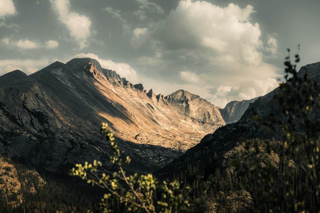
Located directly against the foothills of the Rocky Mountains, Boulder is home to the iconic Flatirons rock formations that rise dramatically to the west, signaling the start of your mountain adventures.
If I only have time to see one thing, what should it be?
If you’re short on time, take the Chautauqua Trail for stunning views of the Flatirons and a true Boulder experience.
The trail offers a range of difficulty levels.
👉Find your perfect base camp in Boulder for an early morning trek or a sunset hike. From cozy mountain lodges to convenient city hotels, choose accommodations that give you easy access to Boulder’s top trails.
How far are hiking trails from town?
Boulder has the advantage of having numerous incredible trails that are either within walking distance of downtown or accessible with a short bus ride.
Popular trailheads such as Chautauqua and Mount Sanitas are located near the city’s edge.
However, if you wish to explore further into the mountains, having a car will provide you with more options.
Is Boulder walkable? Do I need a car?
Boulder is a very walkable city, especially the downtown core, Pearl Street Mall, and the University of Colorado campus.
You can easily enjoy a trip without a car and still access some fantastic trails.
However, having a car gives you more flexibility to explore a broader range of hikes and destinations beyond the city limits.
👉Let Skyscanner be your gateway to exploring Boulder’s outdoor wonders. Secure your flight and immerse yourself in the natural beauty of the Front Range, with trails that cater to every skill level, from novice to experienced hikers.
Things to Know Before You Go

Adjusting to the Altitude:
Boulder is situated at over 5,000 feet above sea level.
If you are coming from a lower altitude, it is important to give your body time to adjust.
Stay hydrated by drinking plenty of water before and during your hikes.
Start with shorter and easier trails on your first day or two, and avoid overexertion.
Pay close attention to your body – symptoms of altitude sickness may include headache, nausea, fatigue, and difficulty sleeping.
If you experience any of these symptoms, it is best to descend to a lower altitude for a while.
👉Book your stay in Boulder and wake up to the adventure of the Flatirons. Discover accommodations near Chautauqua Park for immediate access to some of the best hikes in the area.
Boulder’s Weather is Unpredictable:
When you’re planning a trip to the mountains, it’s important to be prepared for any kind of weather.
Even if the forecast predicts sunshine, it’s always a good idea to pack a rain jacket, a warm layer like a fleece, and a hat to protect yourself from the sun.
Temperatures can change quickly in the mountains, and it’s not uncommon to experience afternoon thunderstorms, especially during the summer months.
To avoid getting caught in a lightning storm, it’s best to start your hikes early in the day.
Hiking Without a Car:
It’s possible to enjoy some of Boulder’s best hikes without a car.
The RTD bus system provides access to many popular trailheads, offering a great car-free option.
Consider exploring scenic trails and pathways in the city and surrounding areas by renting a bike.
👉Skyscanner takes you to the heart of Boulder’s hiking paradise. Book your flight today and lace up your hiking boots for the trails of Bear Peak, where panoramic city views and rugged wilderness await.
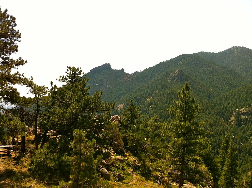
Flatirons Vista
Difficulty: Easy
Distance: 3.5 miles
Dogs allowed: Yes, but see regulations
Looking for a quiet hiking trail away from the crowds?
Look no further than Flatirons Vista, located south of town.
This trail features an easy terrain that is perfect for families and trail runners.
Moreover, the trail offers a wide-open landscape with a breathtaking view of the entire mountain range.
Photographers will love the sweeping views and ample sunshine that provide an excellent opportunity for capturing stunning photos.
Don’t forget to apply sunscreen before starting your hike, and keep an eye out for eagles soaring over this exposed route.
If you’re looking for a longer adventure, several trails intersect with Flatirons Vista, offering endless opportunities for customization.
Reasons why this trail is amazing:
- Unparalleled panoramic views of the entire Flatirons range
- Easy terrain makes it welcoming to hikers of all abilities
- Its open, sunny landscape provides a distinctive Colorado experience
- Feels less crowded than trails directly at the base of the Flatirons
- Numerous connecting trails for longer hikes or to explore a variety of terrain
👉Secure a retreat in Boulder that’s as adventurous as you are. Choose from a variety of stays nestled near trailheads, ensuring you’re never far from your next hike.
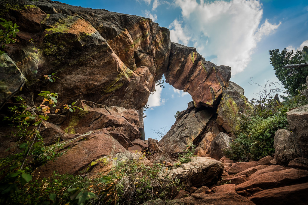
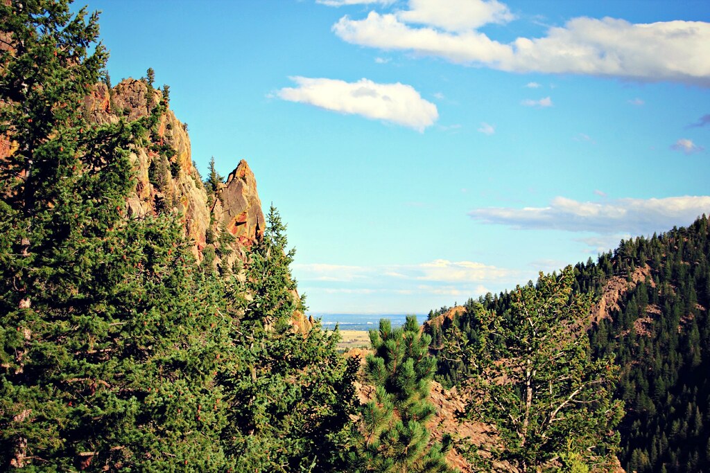
Royal Arch Trail
Difficulty: Challenging
Distance: 3.3 miles
Dogs allowed: Yes, but see regulations
This Boulder hike is a must-try for adventure seekers.
It offers a challenging yet rewarding climb and lets you witness incredible views while standing on a majestic natural arch.
The hike starts from the Chautauqua Trailhead and takes you through a beautiful meadow and lush pine forest before you begin climbing the steep and rocky ascent towards Sentinel Pass.
Be sure to keep an eye out for trail signs as other routes intersect here.
Once you reach the top of the pass, you’ll need to do a short scramble to get to the impressive Royal Arch.
From here you can enjoy panoramic views of the Flatirons and Boulder below.
Reasons why this trail is amazing:
- The awe-inspiring Royal Arch formation
- Expansive views of the Flatirons and Boulder
- Diverse scenery, from meadows to forests and rock formations
- A true Boulder classic, popular with locals
- Option to connect with other trails from Chautauqua for a longer adventure
Important Notes:
- This trail is considered challenging due to its steep climb and uneven terrain.
- Be prepared for crowds, especially on weekends.
- Check the OSMP website for parking fees, shuttle schedules, and dog regulations.
- This is a very popular area for hiking, mountain biking, and running, so you’ll likely encounter other people while exploring. The best times to visit this trail are March through October. Dogs are welcome, but must be on a leash.
👉Journey to Boulder with Skyscanner for a trekking experience like no other. Find your flight and prepare to explore the diverse terrain, from the lush forests of Walker Ranch to the striking rock formations of the Mesa Trail.
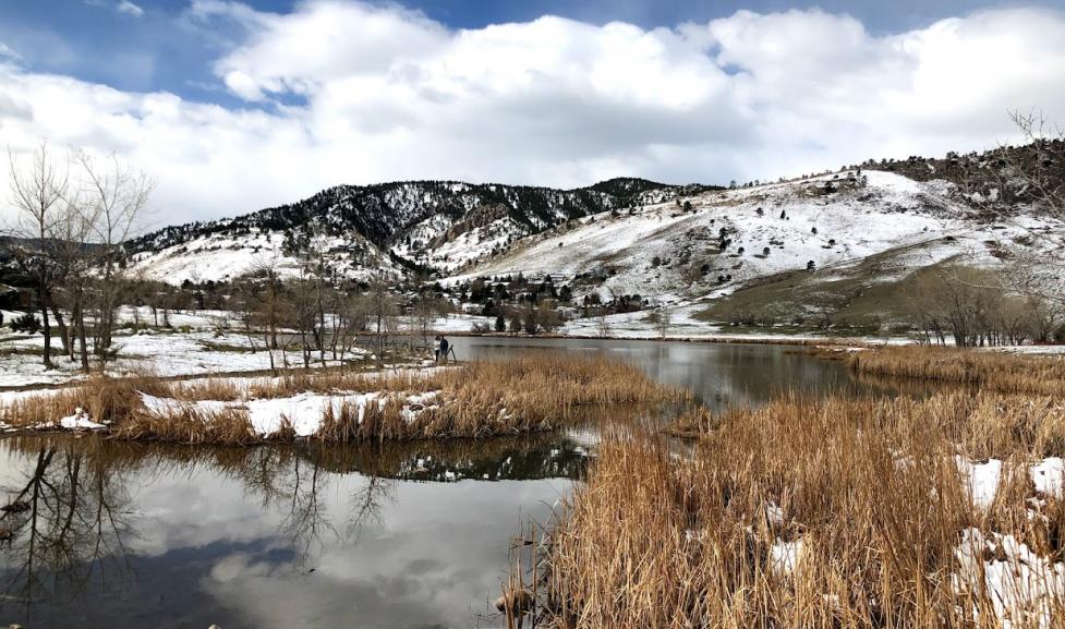
Wonderland Lake Loop Trail
Difficulty: Easy
Distance: 1.5 miles
Dogs allowed: Yes, but must be on a leash
Are you interested in taking a peaceful walk while enjoying beautiful scenery?
Look no further than the family-friendly loop trail that surrounds Wonderland Lake in North Boulder.
This trail offers breathtaking views of the water with the iconic Flatirons as a majestic backdrop.
The path is a mix of paved and dirt, and winds through trees and open spaces, making it the perfect choice for walkers, runners, and anyone looking for an easy nature escape.
Don’t forget to keep an eye on the sky, as you might catch paragliders launching from nearby Wonderland Hill.
Reasons why this trail is amazing:
- Great for all abilities, including families with young children
- Beautiful lake views with the Flatirons in the distance
- Easy access from North Boulder neighborhoods
- Perfect for a quick nature fix or sunset stroll
- Potential to see paragliders in action
👉Immerse yourself in Boulder’s hiking culture with accommodations that cater to outdoor enthusiasts. From gear storage to trail advice, find a place that helps you make the most of your trekking experience.
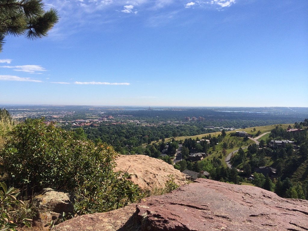
Mount Sanitas (Mount Sanitas Peak Trail, or Lion’s Lair Trail)

Difficulty: Challenging (Peak Trail), Moderately Challenging (Lion’s Lair)
Distance:
- Peak Trail: 3 miles roundtrip
- Lion’s Lair Trail: 4.1 miles roundtrip
Dogs allowed: Yes, on leash for both trails
Explore the iconic Mount Sanitas in Boulder by conquering its peak!
The mountain offers two challenging trails that lead to the summit and reward hikers with breathtaking 360-degree views of the city, the Flatirons, and the peaks of the Continental Divide.
However, be prepared for a workout as both routes involve a steady climb with some rocky sections.
The hike is incredibly popular, so expect crowds, especially on weekends.
For a less crowded experience, consider a hike on a weekday or during the winter.
Choosing Your Route:
- Mount Sanitas Peak Trail: The classic route – shorter but steeper with a relentless climb. Perfect for those wanting a quick, intense challenge.
- Lion’s Lair Trail: A slightly longer option with switchbacks through a pine forest. It offers more shade and gradual elevation gain but is still considered moderately challenging.
Reasons why Mount Sanitas is amazing:
- Panoramic views from the summit make the effort worth it!
- Popular for a reason – a true Boulder “must-do” hike
- Easily accessible from downtown Boulder
- Two trail options to cater to different fitness levels
Important Notes:
- Arrive early as parking fills up quickly.
- Bring plenty of water and sunscreen.
- Weekdays or winter offer a less-crowded experience
👉Discover Boulder’s hidden hiking gems with Skyscanner. Secure your flight to uncover less-traveled paths like the Green Mountain West Ridge and the Anemone Trail, promising solitude and stunning panoramas.
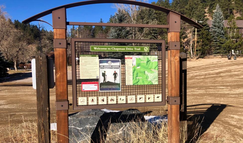
Chapman Drive and Tenderfoot Trail Loop
Difficulty: Moderate
Distance: 2.5 miles
Dogs allowed: Yes, but see regulations
This loop trail is perfect for those who love scenic views.
Begin your journey with a picturesque drive up Flagstaff Mountain to Realization Point, where you can enjoy panoramic vistas of Boulder below.
Then, set out on a delightful hike along the wide Chapman Drive.
Throughout your hike, you can bask in the expansive views of the canyon and snow-capped Indian Peaks that will unfold with every step.
If you want to explore further, take a detour onto the Tenderfoot Trail for a wildflower-filled meadow stroll.
Don’t forget to seek out the overlook spur trail for even more breathtaking views of Colorado’s highest summits.
Reasons why this trail is amazing:
- Scenic drive to the trailhead sets the stage for the adventure
- Mix of wide paths and single-track trails for variety
- Stunning views of Boulder, the Indian Peaks, and a canyon draped in pines
- Wildflower meadows in season add a burst of color
- Easily accessible from Boulder with a rewarding scenic payoff
Notes:
- Parking at Realization Point can be crowded, especially on weekends.
- This trail shares sections with mountain bikers, so stay alert.
👉Experience the tranquility of Boulder’s natural landscapes with stays that offer a peaceful respite after a day on the trails. Book accommodations surrounded by nature, from rustic cabins to luxury resorts with mountain views.
Green Mountain West Trail
Difficulty: Moderate
Distance: 2.8 miles
Dogs allowed: Yes, but see regulations
Looking to conquer one of Boulder’s iconic peaks?
The West Trail offers a slightly easier, less crowded route to the summit of Green Mountain.
The trail starts with a gentle stroll through a pleasant forest before it transitions into a series of steep switchbacks, which will give your legs a good workout.
Once you reach the top, you’ll need to scramble over some boulders to get to the true summit.
Here, you’ll find a bronze marker and stunning 360-degree views.
Take a moment to soak up the landscapes that encompass Boulder, the surrounding peaks, and a bird’s-eye view of the city below.
Reasons why this trail is amazing:
- A quieter alternative for summiting the popular Green Mountain
- Rewarding views with slightly less elevation gain compared to other routes
- A mix of mellow meandering and challenging switchbacks
- The thrill of a final boulder scramble to the summit
- Epic 360-degree panoramas from the top
Important Notes:
- Limited parking – arrive early or consider a weekday hike
- The final push to the summit requires good footwear and scrambling ability
👉Experience Boulder’s natural beauty with Skyscanner. Book your flight and set off on unforgettable hikes, including the Mount Sanitas Trail and the Gregory Canyon Trail, each offering unique landscapes and breathtaking views.
Rattlesnake Gulch Trail
Difficulty: Moderate
Distance: 3.6 miles
Dogs allowed: Yes, on leash
Are you ready for an adventure through history and breathtaking scenery in Eldorado Canyon State Park?
The Rattlesnake Gulch Trail is a moderately challenging hike that offers dramatic canyon views and expansive vistas of Colorado’s plains.
Follow the trail and you will come across the ruins of the historic Crags Hotel, which serves as a reminder of the area’s rich past.
Keep walking, and you will reach the Continental Divide Overlook, where you’ll be able to enjoy stunning panoramas that will take your breath away.
Reasons why this trail is amazing:
- Immerse yourself in the rugged beauty of Eldorado Canyon
- Explore a piece of history at the Crags Hotel ruins
- Sweeping views from the Continental Divide Overlook
- Easy access from Boulder makes this a fantastic day trip
- Potential for wildlife sightings
Important Notes:
- Timed-entry reservations or the Eldo Shuttle are needed on weekends/holidays (May 15-Sept 15).
- Be prepared for some elevation gain and exposed sections of trail.
- Keep an eye out for rattlesnakes, especially in warmer weather.
👉Let Boulder be your playground with strategically located accommodations. Choose stays that offer quick access to both city attractions and mountain trails for a balanced visit.
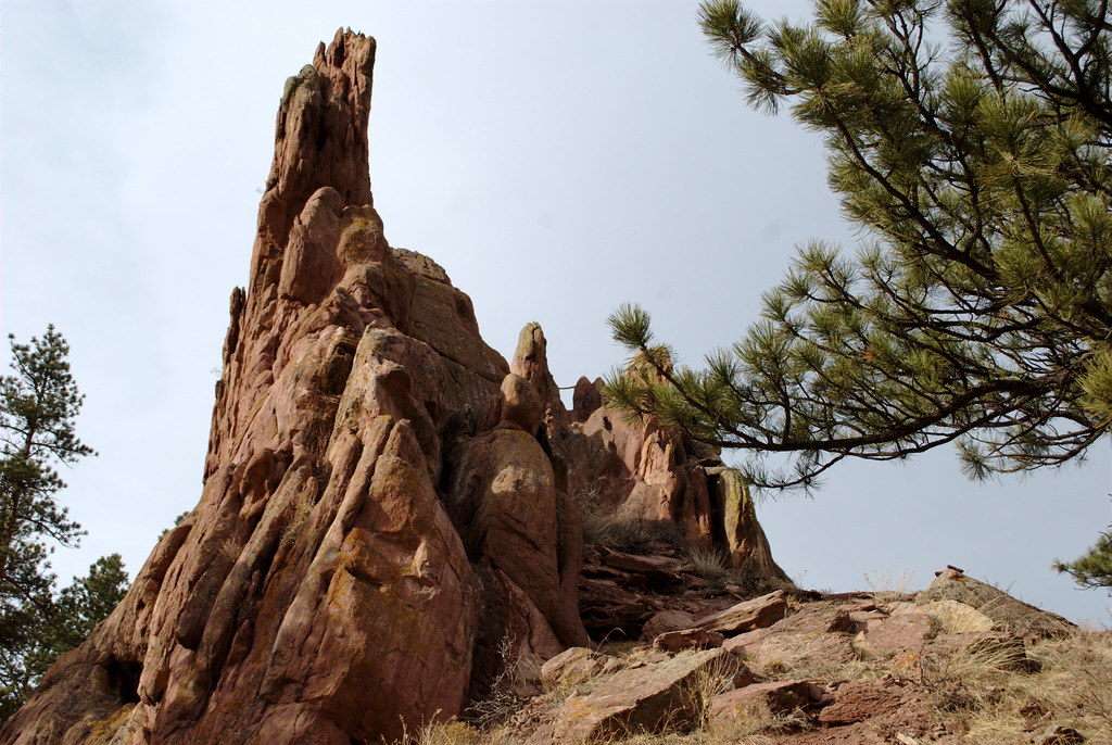
Second & Third Flatirons Loop
Difficulty: Moderate to Difficult
Distance: 2.5 miles
Dogs allowed: Yes, but see regulations
Get ready to explore the magnificent Flatirons like never before!
This challenging loop trail begins at the picturesque Chautauqua Meadow, where you can admire the breathtaking views of the Flatiron rock formations framed by colorful wildflowers.
The trail takes you through lush forests and rocky scree fields before you reach the notch between the Second and Third Flatirons.
Take a moment to pause and capture the unforgettable scenery with the towering Third Flatiron in the background – it’s a view that you won’t want to miss!
Reasons why this trail is amazing:
- Immerse yourself in the grandeur of the Flatirons
- Diverse scenery, from meadows to rock scrambles and pine forests
- Up-close views of these iconic rock formations
- A true Boulder classic, offering a sense of accomplishment
- Starts at the beautiful and popular Chautauqua trailhead
Important Notes:
- The challenging terrain includes elevation gain and rock scrambling.
- Be prepared for crowds, especially on weekends.
👉With Skyscanner, the best of Boulder’s hiking is just a flight away. Find great deals and experience the majestic vistas of the Rocky Mountains, the peaceful ambiance of Boulder Creek Path, and the diverse ecosystems of the Boulder Valley.
Red Rocks Trail
Difficulty: Easy to Moderate
Distance: 0.7 miles
Dogs Allowed: Yes, but see regulations
Where to Park: The Peoples’ Crossing (formerly “Settlers Park”) – walking distance from downtown Boulder
Escape the hustle and bustle of the city and discover Boulder’s hidden gem!
The Red Rocks Trail is just a short walk from downtown and leads you into a world of warm, rust-colored rock formations.
This path is perfect for families with gentle climbs and easy scrambling, making it ideal for adventurous kids.
You can find a sun-drenched boulder and enjoy the unique scenery or pack a picnic for a scenic lunch spot.
While it might not have the concerts of its famous namesake, Boulder’s Red Rocks offers its own special charm and a touch of Colorado’s dramatic landscape.
Reasons why this trail is amazing:
- Easily accessible from downtown Boulder – no car needed!
- Fun scrambling rocks that are perfect for kids
- Unique sandstone formations offer a different perspective on Boulder
- Great spot for a scenic picnic or relaxing on the rocks
- A quick and rewarding nature escape
👉Plan your ultimate hiking getaway in Boulder by booking accommodations that prioritize comfort and convenience. Find spots with hot tubs and cozy fireplaces to relax your muscles after a day of exploration.
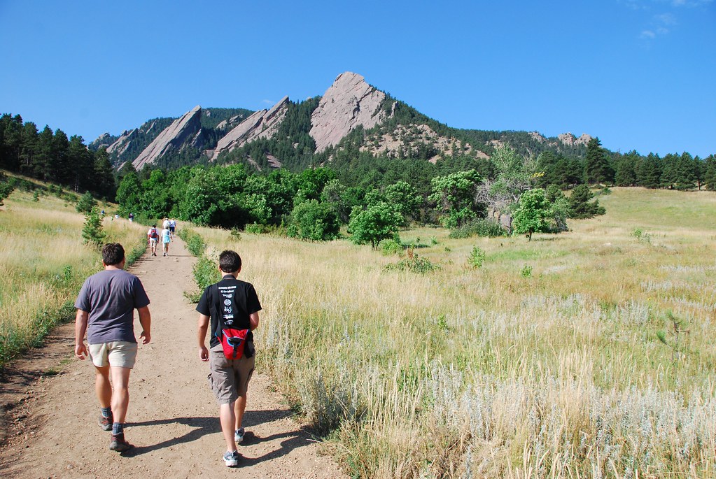
Chautauqua Trail
Difficulty: Easy to Moderate
Length: 1.2 miles out-and-back
Elevation Gain: 459 feet
Dogs Allowed: Yes, but see regulations
Immerse yourself in the heart of Boulder’s outdoor scene!
The Chautauqua Trail is a must-do, offering a quintessential Boulder experience with breathtaking views of the iconic Flatirons.
This well-trodden path winds through the historic Chautauqua Meadow, making it popular with locals and visitors alike.
While the trail starts out easy, be prepared for a bit of a climb and remember that the lack of shade means extra sun exposure.
Pack plenty of water, and take time to read the signs along the way for insights into the area’s rich history.
The Chautauqua Trail is also your gateway to countless other adventures, as numerous trails branch off from this central hub.
Reasons why this trail is amazing:
- Iconic Flatirons views throughout
- A true Boulder classic, perfect for all ability levels
- Historic and cultural significance of the Chautauqua area
- Access point for a vast network of trails
- Great for both a quick stroll or the start of a longer hike
Important Note: Bring ample water and sun protection, as shade is limited.
👉Let Skyscanner be your gateway to exploring Boulder’s outdoor wonders. Secure your flight and immerse yourself in the natural beauty of the Front Range, with trails that cater to every skill level, from novice to experienced hikers.
Mesa Trail

Difficulty: Moderate to Challenging (varies due to length)
Length: 6.3 miles (Point to Point)
Elevation Gain: 1714 feet
Dogs: May be off-leash per City of Boulder Voice and Sight Program
Explore the diverse landscapes of Boulder by embarking on the sprawling Mesa Trail.
This lengthy route takes you through rolling hills, lush valleys, and stands of ponderosa pine, providing you with ever-changing scenery at every step.
Be ready for a workout as you navigate climbs and descents, but you’ll be rewarded with breathtaking views of both the majestic Flatirons to the west and the expansive plains stretching to the east.
The Mesa Trail is truly a Boulder connector, intersecting with numerous trails, such as Bear Canyon, Shadow Canyon, and more – offering endless options for customizing your adventure!
Reasons why this trail is amazing:
- Long and versatile – tailor your hike to suit your fitness level
- Beautiful views of both the mountains and plains
- Diverse terrain for a challenging and engaging experience
- Abundant opportunities to connect with other Boulder trails
- Potential to spot wildlife like deer, hawks, and even bears or mountain lions (stay aware!)
Important Notes:
- Some sections are exposed to the sun – bring water and sun protection
- The southern end features a significant descent into Eldorado Canyon
- Be aware of wildlife and follow safety guidelines
👉Discover the heart of Boulder’s wilderness by staying close to its renowned hiking paths. Book accommodations that serve as your gateway to the great outdoors, ensuring every day is an adventure.
Find Your Boulder Adventure!
The trails of Boulder are just waiting to be explored!
Whether you’re drawn to the iconic Flatirons views, crave a challenging climb with breathtaking rewards, or seek a leisurely nature stroll with beautiful scenery, there’s a perfect hike for you.
It’s time to lace up your boots, pack your water bottle, and hit the trail.
So what are you waiting for?
Start exploring the trails of Boulder and discover the magic of hiking in this extraordinary mountain town!
👉Skyscanner takes you to the heart of Boulder’s hiking paradise. Book your flight today and lace up your hiking boots for the trails of Bear Peak, where panoramic city views and rugged wilderness await.